Street
Rue de l'Abreuvoir
Rue de l’Abreuvoir may be only 133 metres long, but its route reaches back to a path shown in 1672. Walking it today reveals how one small Montmartre street survived the hill’s transformation—and a decree that nearly erased it.
Selected by Arthur
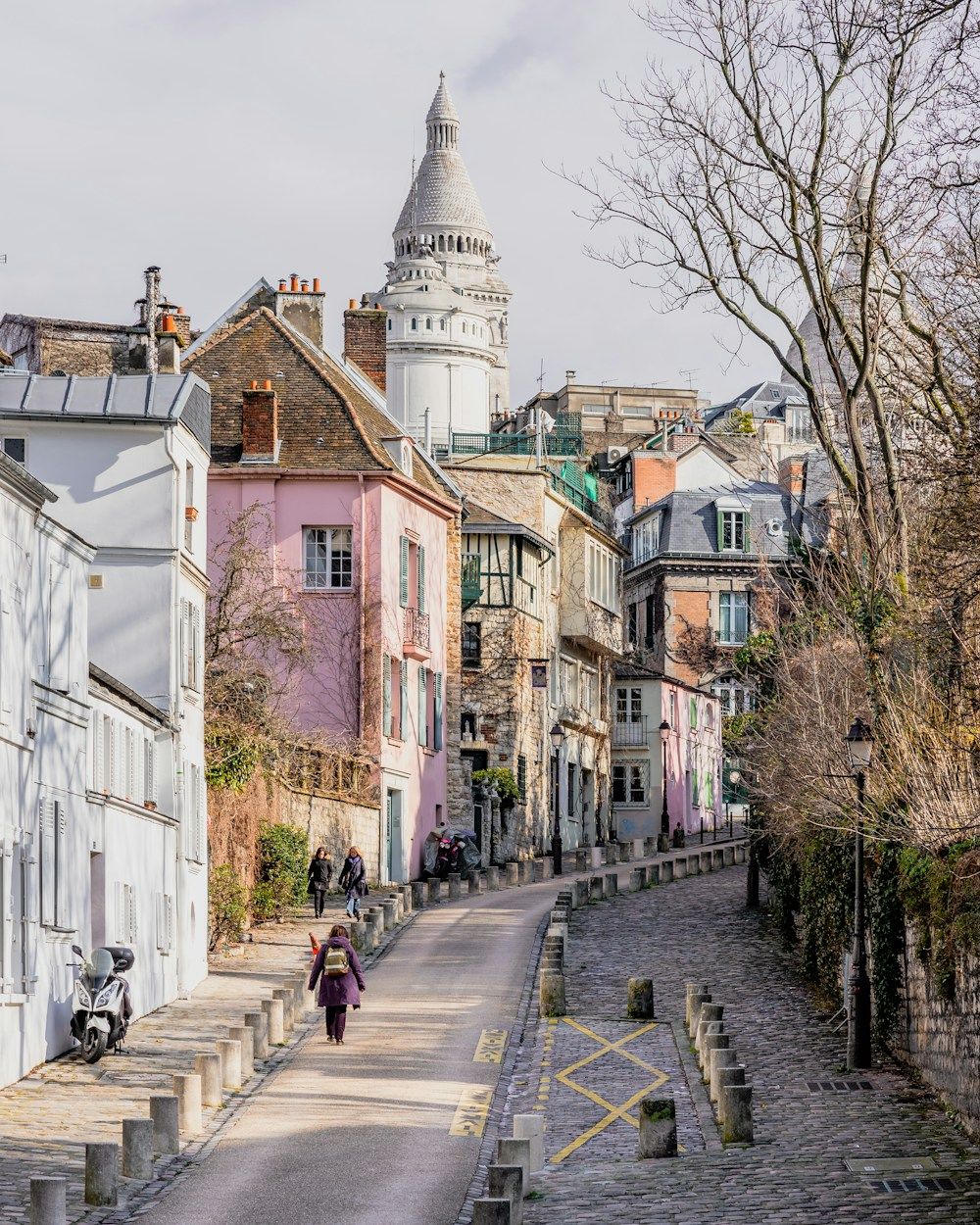
A walk along the old village lane
Visit Rue de l’Abreuvoir for the street itself rather than for a single monument. Between Rue des Saules and Place Dalida, its short course condenses several chapters of Montmartre’s urban history into a walk that can be followed from end to end.
Its name remembers the old watering place to which the path once led, while its survival tells an even less familiar story. The road became part of Paris, was then marked for removal, and ultimately remained. Once you know that chronology, these 133 metres feel less like a shortcut and more like a surviving line through the hill’s past.
The story behind the curve
Rue de l’Abreuvoir is easy to recognise by name, yet the most interesting part of the visit is not a single façade or landmark. It is the street’s own route. Over just 133 metres, a former path, an old Montmartre place name and a plan that could have made the road disappear all meet in the same story.
A path already traced in 1672
The story begins before Rue de l’Abreuvoir was formally a Paris street. Its course appears as a path on a map dated 1672, placing the line of the road deep in Montmartre’s history without pretending that the street already existed in its present form.
In 1843, it was known as Chemin de l’Abreuvoir. The name referred to the old Montmartre watering place to which the path led. That simple origin is worth keeping in mind as you walk: the name is not decorative, but a fragment of the former landscape preserved in everyday Parisian geography.
From the commune of Montmartre to the Paris street network
At that time, the road belonged to the former commune of Montmartre. It entered the Paris street network by decree on 23 May 1863, one of the administrative changes that accompanied the hill’s integration into the capital.
This transition gives the street a double identity. Its history began before it became part of Paris, but the same route continued after the administrative boundary changed. The line on the map survived even as the place around it acquired a new status.
The decree that almost erased the street
The most surprising chapter came only four years later. A decree issued in 1867 planned to remove Rue de l’Abreuvoir in order to open Rue Chasseloup-Laubat. Had that project gone ahead, the path remembered since the seventeenth century would have been interrupted by a new piece of city planning.
The decision was finally revoked in 1899. Rue de l’Abreuvoir remained, and today it links 9 Rue des Saules to Place Dalida within the site known as Vieux Montmartre. Its survival is therefore not just a picturesque detail: it is part of the street’s documented history.
That is the best way to approach the walk. Follow the public street from one end to the other and let its name, dates and route do the storytelling. Rue de l’Abreuvoir does not need an invented legend; the fact that this small line endured is already a compelling Montmartre story.
Practical notes
Walk the complete 133-metre route between Rue des Saules and Place Dalida rather than treating Rue de l’Abreuvoir as a single photo stop. Its modest length makes it easier to understand the street as one continuous historic line.
This is a public street, not a visitor attraction with one entrance or a prescribed circuit. It fits naturally into a wider walk through Vieux Montmartre, and you can approach it from either end without missing part of the route.